
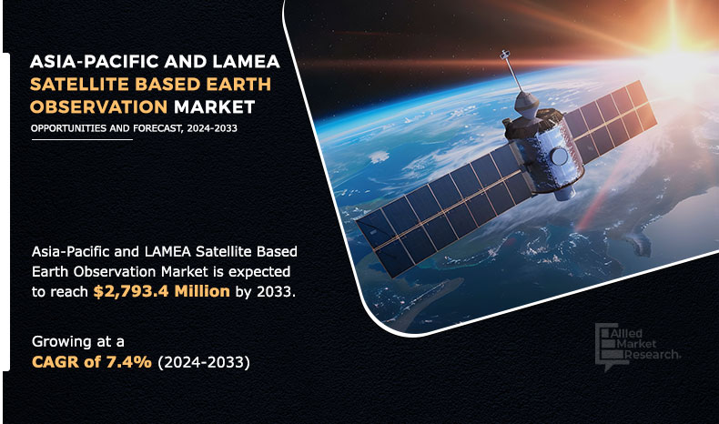
The Asia-Pacific and LAMEA satellite based earth observation market was valued at $1,399.4 million in 2023 and is estimated to surpass $2,218.1 million by 2033, exhibiting a CAGR of 7.4% from 2024 to 2033.
Satellite-based earth observation involves utilization of satellites orbiting the earth to collect data pertaining to different facets of the earth's surface, atmosphere, and oceans. Satellite-based earth observation process utilizes remote sensing technique to collect information on chemical, physical, and biological aspects of earth. The information collected through remote sensing is used for several applications such as weather & terrain mapping, reconnaissance & intelligence missions, agricultural monitoring & management, synthetic aperture radar imagery, and others. In addition, collected information is used by the defense sector for border monitoring, disaster management, and other military missions. The Asia Pacific and LAMEA satellite based earth observation market size has witnessed substantial growth due to increased investments in space technology and the rising demand for precise environmental monitoring solutions.
Key Takeaways
- On the basis of product type, the value-added services segment held the largest share in the Asia-Pacific and LAMEA satellite based earth observation market in 2023.
- On the basis of satellite orbit, the low earth orbit segment held the largest share in the Asia-Pacific and LAMEA satellite based earth observation market in 2023.
- By end-use, the defense segment held the largest share in the market in 2023.
- By region, Asia-Pacific held the largest share in the market in 2023.
The growth of the Asia-Pacific and LAMEA satellite-based earth observation market is majorly driven by surge in demand for big data technology to generate accurate insights on earth observation data, advancements in earth observation satellite technologies, and high-demand for high-resolution imaging services. However, the rise in utilization of alternative earth observation technologies such as aerial drones and high-altitude balloons and lack of skilled & trained personnel hinder the growth of the market. On the contrary, an increase in investments by several governments in space technology is anticipated to offer remunerative opportunities for the players operating in the market during the forecast period. Key Asia Pacific and LAMEA satellite based earth observation market trends include the adoption of small satellite constellations, advancements in sensor technologies, and the rising use of artificial intelligence for data interpretation.
The leading companies profiled in the report include Airbus, Satellogic, Maxar Technologies, Planet Labs, BlackSky, MDA, Spire Global Inc, SpaceWill, SATPALDA International, Bayanat AI. A comprehensive Asia Pacific and LAMEA satellite based earth observation market analysis reveals significant opportunities for growth, driven by technological advancements and the integration of big data analytics.
Segment Review
The Asia-Pacific and LAMEA satellite-based earth observation market is segmented into product type, satellite orbit, end-user, and region. By product type, the market is divided into EO data and value-added services. On the basis of satellite orbit, it is classified into low earth orbit, medium earth orbit, and geostationary orbit. Depending on end use, it is fragmented into defense, urban development & cultural heritage, agriculture, climate services, energy & raw materials, infrastructure, and others. Region wise, the market is analyzed across Asia-Pacific, and LAMEA.
By Product Type
On the basis of product type, the value added services segment generated maximum revenue in 2023, owing to rise in demand for value added services of satellite earth observation imagery, data on demand services, and geospatial analytics services for land cover classification, urban growth monitoring, and other applications. The key players in the industry such as Airbus and Maxar Technologies have focused on providing observation as a service, predictive analytics, change detection, advanced data analytics, and other services.
By Product Type
Value added services is projected as the most lucrative segment.
Companies in the regions specializing in capturing, processing, and analyzing images of the Earth's surface are collaborating with organizations of different countries that provides services related to launching payloads into space and developing space systems. For instance, in August 2023, iQPS a Japanese Earth imaging company partnered with Rocket Lab, a global launch services and space systems company to launch an Earth observation satellite. This launch is a critical step for iQPS in building its SAR satellite constellation, which aims to offer near real-time Earth observation data and services for various applications such as disaster prevention and infrastructure management.
By Satellite Orbit
On the basis of satellite orbit, the low earth orbit segment generated maximum revenue in 2023, owing to increase in demand for high-resolution imagery, and technological advancement. Enhanced crop monitoring and precision farming techniques require high-resolution imagery to optimize yields and manage resources efficiently. The growing commercial market for EO data and services, including sectors like mining, forestry, and water resource management, is boosting demand for LEO satellites.
By Satellite Orbit
Medium Earth Orbit is projected as the most lucrative segment.
By End-use
On the basis of end-use, the defense segment generated maximum revenue in 2023, owing to the rise in need for satellite earth observation data and services for situational awareness to improve the operational efficiency and mitigate risks for deployed forces. Moreover, satellite imagery facilitates the identification and evaluation of potential targets like enemy installations, weapon systems, and infrastructure. For instance, in February 2024, BlackSky Technology Inc. secured approximately $50 million in multi-year contracts to provide its Gen-3 Earth observation capabilities and services to the Indonesian Ministry of Defense (MoD). This includes delivering advanced Gen-3 satellites, ground station capabilities, and flight operations support.
By End-use
Energy and Raw Materials is projected as the most lucrative segment.
By Region
By region, Asia-Pacific generated maximum revenue in 2023, owing to adoption of satellite-based earth observation is expected to increase in the countries such as India, China, and Japan, due to high investment in defense, retail, military, and public transportation sectors. Asia-Pacific is one of the most natural disaster-prone regions affected by floods, earthquakes, cyclones, and other calamities, which increases the need for surveillance to map, monitor, and analyze vulnerable areas, thereby augmenting the demand for satellite-based earth observation solutions. Furthermore, the region is witnessing notable economic growth and industrial expansion, resulting in heightened requirements for data and insights across diverse sectors such as agriculture, infrastructure development, urban planning, and environmental monitoring.
Several countries in this region, including China, India, Japan, and South Korea, have initiated ambitious space programs aimed at bolstering their satellite capabilities. For instance, in November 2023, India and the U.S. announced a collaboration on the launch of a joint microwave remote sensing satellite for earth observation, named NASA-ISRO Synthetic Aperture Radar (NISAR).
Competitive Analysis
The Asia Pacific and LAMEA satellite based earth observation market share is dominated by a few key players who provide advanced imaging services and data analytics for various applications. The key players profiled in the Airbus, Satellogic, Maxar Technologies, Planet Labs, BlackSky, MDA, Spire Global Inc, SpaceWill, SATPALDA International, Bayanat AI.
Advancements in earth observation satellite technologies
Technological progress in earth observation satellites leads to the development of advanced sensors and instruments, enabling satellites to gather a wider range of data with greater accuracy and precision. These enhancements enable satellites to capture detailed information about diverse earth phenomena, including land use, vegetation health, climate patterns, and natural disasters. Consequently, the increased availability of comprehensive and high-quality data appeals to a broader array of users and applications, stimulating market growth. Leading players across the globe have made many advancements in satellite technology (such as hyperspectral and multispectral imaging and additive manufacturing) to further expand the capabilities of satellites, decrease the cost, and improve the customizability of satellites. The Asia Pacific and LAMEA satellite based earth observation market growth is fueled by the increasing need for high-resolution satellite imagery in sectors such as agriculture, disaster management, and urban planning.
Hyper-spectral and multi-spectral imaging enhance the capabilities of satellites in collecting precise data about the changes in the environment. Hyperspectral sensors produce images comprising highly detailed spectral data that allow the detection of micro-level changes in the environment such as in soil, crops, and water. Multispectral sensors, on the other hand, provide a clear perception of details on the ground, such as spotting pest-infested trees. For instance, the NASA-ISRO Synthetic Aperture Radar (NISAR) satellite, set to launch in 2024, is a joint effort between NASA and the Indian Space Research Organisation (ISRO). It will utilize radar technology to continually scan earth's surface, aiming to monitor changes in landscapes over time.
The NISAR satellite contains two different synthetic aperture radar (SAR) systems, the L-band SAR, developed by NASA and the S-band SAR, developed by ISRO. Moreover, advancements in satellite imaging technology result in improved spatial, spectral, and temporal resolutions, allowing satellites to capture finer details and distinguish between various land features and environmental changes.
The higher resolution imagery facilitates more precise analysis and monitoring of earth's surface, supporting applications such as urban planning, agriculture management, environmental monitoring, and disaster response. This availability of high-resolution data attracts industries and organizations seeking accurate and actionable insights, thereby fueling the expansion of the market. There is a tremendous Asia Pacific and LAMEA satellite based earth observation market opportunity, especially for companies that can offer innovative solutions and services tailored to the specific needs of these regions.
High-demand for high-resolution imaging services
Satellites provide high-resolution imagery for monitoring and verifying applications in various sectors, including civil engineering & construction, government, defense & intelligence, agriculture & forestry, transportation, and real estate. Satellite imaging is applicable in topographic mapping, understanding land applications such as infrastructure planning and construction, mitigating the impact of disasters, and monitoring drilling projects in the oil & gas industry. Furthermore, companies receive contracts from government entities to supply imaging services to meet their specific operational and security objectives.
For instance, in February 2024, BlackSky, a provider of earth observation and data analytics services, secured a $50 million contract to supply satellite imagery services and imaging spacecraft to the Republic of Indonesia. Partnering with Thales Alenia Space, BlackSky will support the Indonesian Ministry of Defense in establishing a sovereign earth imaging satellite network tailored to the country's national security needs. Moreover, high-resolution satellite imagery assists in monitoring vegetation, green mapping, vegetation damage due to leaching, traffic management, and tracking of fleet.
In the coming years, satellite imaging is expected to be significantly used in the real estate industry for an enhanced view of buildings and properties, and in the insurance sector for accessing environmental risk through accurate and updated geographical data. The Asia Pacific and LAMEA satellite based earth observation market size has seen significant expansion due to a surge in demand for high-resolution satellite imagery and advancements in satellite technologies.
Lack of skilled and trained personnel
The analysis and interpretation of earth observation data demands specialized expertise in remote sensing, geographic information systems (GIS), and data analysis techniques. Proficient professionals are indispensable for deriving meaningful insights from the extensive satellite imagery collected, crucial for applications like environmental monitoring, urban planning, agriculture, and disaster management. The operation and maintenance of earth observation satellites necessitates proficiency in spacecraft engineering, orbital dynamics, and mission control.
Competent personnel ensure the optimal functioning of satellite systems, including monitoring spacecraft health, executing orbital maneuvers, and resolving technical issues. Skilled individuals are essential for crafting innovative applications and solutions that harness satellite earth observation data to address specific user requirements and challenges. This entails the development of tailored algorithms, software tools, and analytical models to extract actionable insights from satellite imagery. Thus, dearth of skilled and trained personnel presents a notable hurdle to the satellite-based earth observation market, constraining the industry's capacity for robust data analysis and application development.
Rise in utilization of alternative earth observation technologies
Alternative technologies, such as aerial drones, ground-based sensors, and high-altitude balloons, are becoming increasingly capable of capturing detailed earth observation data. This increased competition can lead to decline in market share for satellite-based earth observation services. Competitors from alternative technologies is one of the key deterrent factors of the Asia-Pacific and LAMEA satellite-based earth observation market. The major enterprises such Google and World View Enterprises and several start-ups such as Zero 2 infinity are investing in R&D of high-altitude balloons, which, in turn, is expected to affect the demand for satellite-based earth observation.
In addition, unmanned aerial vehicles (UAVs), such as drones, have been utilized for earth observation applications such as archeological surveying, climate studies, and traffic monitoring. Such applications of alternative technologies are expected to restrain the growth of the market during the forecast period.
Increase in investments by several governments in space technology
The overall space economy consists of revenue-generating commercial space activities and government investments in space. Government investments shaped the space industry in the 20th century, whereas commercial activities are now setting the pace. The private spaceflight industry has evolved at a fast pace with new entrants and private funding creating opportunities for innovations in products, services, and processes. Increase in investments by governments across the Asia-Pacific and LAMEA region for improvement of infrastructure and rise in need to deliver high-quality telecommunication services to consumers are expected to provide remunerative opportunities for the growth of the satellite-based earth observation market during the forecast period market.
Furthermore, high demand for satellite imagery in the government sectors, including federal agencies, local, and state governments for various purposes such as urban planning, border mapping, infrastructure security, homeland security is significantly contributing to the growth of the market. Another factor positively influencing the growth of the market is the large number of satellites that have been launched by various agencies in the regions. For instance, in April 2024, China successfully launched the SuperView-3 (01) satellite, continuing the development of its commercial constellation of remote sensing satellites.
The satellite was launched aboard a Long March 2D rocket from the Jiuquan Satellite Launch Center. The SuperView-3 (01) is China's first commercial optical remote sensing satellite with an ultra-large width of more than 130 kilometers. As a commercial satellite, SuperView-3 (01) demonstrates the viability of commercial ventures in the Earth observation sector. It encourages investment and innovation in the commercial space industry, leading to the development of more advanced satellites and services.
The Asia Pacific and LAMEA satellite based earth observation market forecast indicates robust growth over the next decade, with increasing government investments and private sector participation driving expansion.
Recent Developments in the Asia-Pacific and LAMEA satellite based earth observation Industry
In April 2024, Airbus launched the Pléiades Neo Next program to expand its very high-resolution Earth observation constellation. This new program will result in new satellite assets and capabilities, including enhanced native resolution.
In May 2022, BlackSky received a multi-year contract from PT Len, supporting the Ministry of Defense of the Republic of Indonesia to provide immediate access to subscription-based real time, high-frequency imagery, and analytics services. The contract is an initial task order exceeding $1 million against a new multi-year contract to deliver space-based intelligence capabilities to the Indonesian Ministry of Defense.
In September 2023, Bayanat AI partnered with HySpecIQ and AzurX to enable hyperspectral imaging and analysis for the UAE. Hyperspectral imaging is a powerful technology that enables identification of objects from space. The relationship between HySpecIQ and Bayanat supports the creation of hyperspectral data applications as well as the development of systems that can combine hyperspectral with other geospatial data to produce high value insights.
In October 2023, Airbus secured a contract from Angola for the first high-performance Angolan Earth observation satellite, Angeo-1 to be produced by Airbus Defense and Space in France. Airbus, Angola’s space partner of strategic importance supplies a state-of-the-art earth observation satellite to facilitate social and economic growth, encompassing many strategic endeavors, including urban planning and the management of valuable natural resources.
In November 2022, Maxar Technologies partnered with -Dabeeo, a geospatial information technology company based on AI to expand its domestic and international earth observation service business. Through this expansion, it aims to provide artificial intelligence technologies to reduce repetitive and exhausting operations that have been performed by humans and assist in efficient operation processing and fast decision-making.
In March 2021, BlackSky partnered with ST Engineering, earth observation and geospatial analysis business company to provide its customers in Southeast Asia an expanded satellite imaging and insights portfolio that include BlackSky products and services. The partnership also allows Geo-Insights and its customers to leverage BlackSky’s imagery data to develop value-added products that are included in Geo-Insights’ offerings.
Key Benefits for Stakeholders
- This report provides a quantitative analysis of the market segments, current trends, estimations, and dynamics of the Asia-Pacific and LAMEA satellite based earth observation market analysis from 2022 to 2032 to identify the prevailing Asia-Pacific and LAMEA satellite based earth observation market opportunities.
- The market research is offered along with information related to key drivers, restraints, and opportunities.
- Porter's five forces analysis highlights the potency of buyers and suppliers to enable stakeholders make profit-oriented business decisions and strengthen their supplier-buyer network.
- In-depth analysis of the Asia-Pacific and LAMEA satellite based earth observation market segmentation assists to determine the prevailing market opportunities.
- Major countries in each region are mapped according to their revenue contribution to the market.
- Market player positioning facilitates benchmarking and provides a clear understanding of the present position of the market players.
- The report includes the analysis of the regional as well as market trends, key players, market segments, application areas, and market growth strategies.
Asia-Pacific and LAMEA Satellite Based Earth Observation Market Report Highlights
| Aspects | Details |
| By Product Type |
|
| By Satellite Orbit |
|
| By End-use |
|
| By Region |
|
| Key Market Players | Satellogic, SATPALDA International, Spire Global Inc, MDA, Bayanat AI, Planet labs, SpaceWill, Airbus, Maxar Technologies, Blacksky |
Analyst Review
"The Asia-Pacific and LAMEA satellite-based earth observation market was valued at $1,399.4 million in 2023 and is estimated to surpass $2,218.1 million by 2033, exhibiting a CAGR of 7.4% from 2024 to 2033."
"The top companies to hold the market share in Asia-Pacific and LAMEA satellite based earth observation are Airbus, Satellogic, Maxar Technologies, Planet Labs, BlackSky, MDA, Spire Global Inc, SpaceWill, SATPALDA International, Bayanat AI"
The leading product type of Asia-Pacific and LAMEA satellite based earth observation market is value added services.
The largest regional market for Asia-Pacific and LAMEA satellite based earth observation market is Asia-Pacific
"The upcoming trends of Asia-Pacific and LAMEA satellite based earth observation market in the world are increase in investments by several governments in space technology, and advancement in earth observation satellite technologies. "
Loading Table Of Content...

